|
|
Return to
WildHiker.com
->
Evolution Valley - Goddard Canyon Backpack Aug 2004
|
|||||||||||
Evolution Valley - Goddard Canyon Backpack, August 2004
|
|||||||||||
|
|
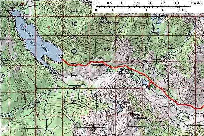
Click on any small photo to see a larger one, or view them in order: Start Here. Our plan was to drive up to the mountains from our home in Palo Alto and start hiking into the wilderness the same day. Normally, we would camp near the trailhead and start hiking the next day in order to acclimatize to the altitude. But the Florence Lake trailhead is relatively low for us (only 7300 feet elevation) so we figured we could hike a few miles and that would put us to a more pleasant wilderness campsite instead of the car campground. We reached the end of the road at Florence Lake in about 6 hours. The last 25 miles from Kaiser Pass is a paved but single lane and very winding highway that takes 1.5 hours to drive. You have to be very careful on blind turns, of which there are many, to watch for oncoming traffic. Someone has to pull into a wide spot or turnout - occasionally backing up - to let the other pass. There are some spectacular views on the drive of the entire San Joaquin basin and its surrounding peaks, including the south boundary country of Yosemite National Park, the Ritter Range, the Silver Divide, and the peaks of the Bear Creek area. |
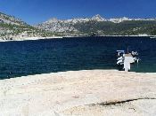 |
There is a major trailhead parking area just above the Florence Lake Store. The store operates a ferry service to take hikers and fishermen across the lake (a reservoir operated by Southern California Edison). This saves five miles of hiking around the lake for a modest fee. We made it to the lake with plenty of time to spare before the last ferry left the dam at 4:30 pm. The ferry provides an excellent view of the peaks around the lake. It docks at the upper end in an area of granite slopes. Colored bricks lead across the granite, past a maintenance shack with a radiotelephone to summon the ferry, to the start of the trail up canyon. The trail starts by climbing up a broad open granite ridge parallel to the South Fork San Joaquin River. |
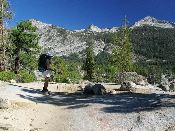 |
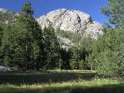
Here Karen views Mt. Shinn as we start hiking about 5 pm. The first five miles of the backpacking trail parallels and crosses a rough jeep trail servicing the private Muir Trail Ranch (a guest ranch), an inholding in the John Muir Wilderness, whose boundary was extended to the edge of Florence Lake in 1984. Because the private ranch predates the Wilderness boundary change, it has continuing rights to use the jeep trail to haul supplies. The jeep trail is an obvious intrusion on the wilderness character. We did not see any vehicle traffic on the jeep trail, although there was an ancient jeep parked by the ferry docking area! |
 |
After gaining about 400 feet elevation in nearly two miles, the trail "tops out" at large Double Meadows. At the upper meadow, the jeep trail continues around the meadow to the north and then down through the forest on a wide arc, while the foot trail heads along the south side of the meadow and then drops rapidly towards the South Fork of the San Joaquin River. At the three mile mark, it reaches an established camping area of widely scattered camps in open forest along the river, at the edge of Blayney Meadows. There is even an old outhouse here. We made our first night's camp here at a quiet riverside site. Statistics for today: 3 miles of hiking, 500 feet of elevation gain, 300 feet of elevation loss. |
| Back to trip main page | On to the second day |